Rupin Pass - The Shepard's Trail ..🌳🐏..🌵🐐...
Rupin Pass
15,250 Ft
Difficult
June 2018
Rupin Pass is a high altitude pass across the Himalayan mountain
ranges & lies on a traditional shepherd's route which starts from Dhaula in Uttarakhand and
ends in Sangla in Himachal Pradesh & is located across
mostly uninhabited areas in the Himalayan ranges at an elevation of
15,250 ft (4,650M) above sea level and is considered among one of the High
range expeditions for trekking in India. The ice melting on the one side of the
pass forms the Rupin river that merges with Yamuna and flows into the Bay of
Bengal, while the snow melting on the Sangla side of the pass merges into Sutlej
and flows into the Arabian sea.
I have been to treks that hardly lasted 2 days, and for a very long time
I have wanted to go on a really lengthy trek. Rupin Pass
was in the back of my mind for quiet sometime. I first came to know about it
from a Travel Vlog on High Altitude Treks in India & is the kind of trek I
was looking forward to. As it’s a difficult trek, despite physical Strength, we
should also be Mentally strong. Imagining its height of 15250ft & more than 70kms (trek agencies will tell you 55kms) of walk is both exciting & also gave me Goosebumps. So, I trained my body
for endurance & building lung capacity. I have also read extensively about breathing, walking & hydration techniques that can come handy. I want to
see how my body responds to high altitude, so I decided not to take Diamox (prevents
altitude sickness) that almost all agencies recommend.
2 days prior to the trek there
was forest fire in Uttarakhand & on the dates of the trek the IMD had issued
a thunder storm alert. The agency asked if I want to cancel, but I wanted
to go. They replied "If the weather turns bad as predicted, we stop. Go to the nearest base-camp possible & stay there. When clear, we return back." Fair enough.
Day 01 ⇒ Dehradun to Dhaula (5,500 Ft):
Reached Dehradun Railway Station (Pick-up
point) in the morning. It was drizzling, a good weather to be in. Freshened up
& reached a Force Traveller (pick-up cab), registered my Name & met
fellow Trekkers. As the cab started, we started chatting. After reaching
Mussoorie (The Queen of Hills) I met other people & had good breakfast,
stomach-full. The mountains & the waterfall in there, looked more beautiful
with the rain added. We reached Purola for lunch. I had hot (jungli murgi) non
veg thali.
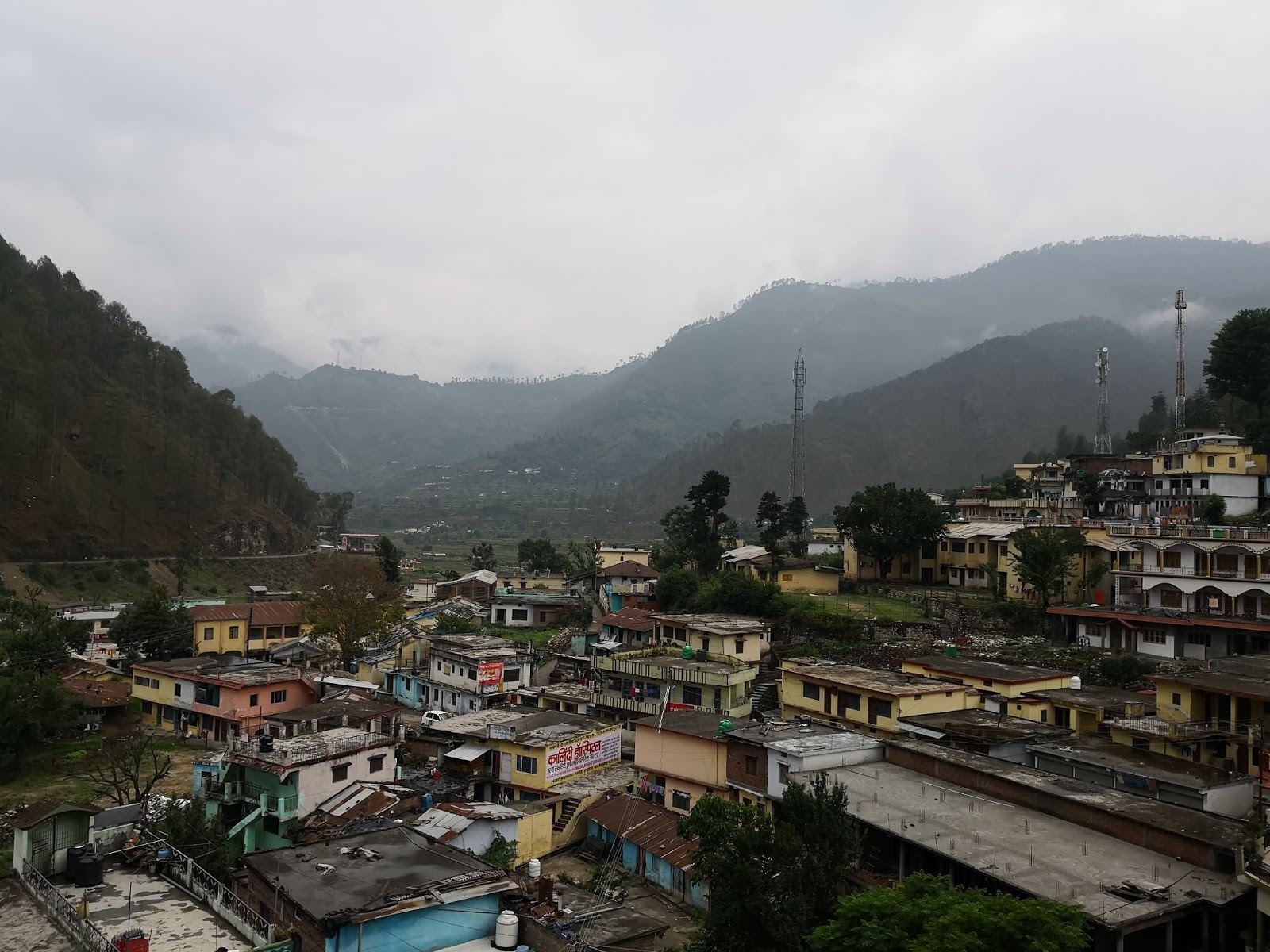
After reaching Govind national park we registered our entry & by evening reached Dhaula. We crossed a bridge to reach our camp-site. I tried calling home, only to realize there is no network.

We were provided camping tents for 2,
beside the Rupin River. My tent mate is Sumit. The group was
asked to get together in a gathering tent at 6:00 clock. So I had my snacks
& tea, took my camera & went to explore the surroundings.

I sat on the side of the bridge, when I met a local man from the village passing
by, carrying grass for his animals. I smiled, conveying my greetings. We soon struck a conversation & sat there, talking. He told me about life in the
mountains, how hard it is, their lifestyle & how they survive in the
winters when the village is completely covered in snow for 3 months.

We gathered at 6:00pm, were given forms to
fill & asked to submit Medical fitness & Declaration forms. We met our Trek Leader Aditya & our
Co-Guides & introduced ourselves & how we prepared
for the trek. After which we are given instructions on what to & what not to do?,
how the trek progresses & how every trek is different, challenges of High-Altitude
Trekking, risks like dehydration, AMS (Acute Mountain Sickness), HAPE (high
Altitude Pulmonary Edema) & HACE (high Altitude Cerebral Edema) & how
they could be fatal if not taken care of!

We are asked to have a buddy &
not to travel alone, to help us motivate, keep us away from Depression in
the coming long trek & to keep an eye on each other. At around 8:00pm we had our Dinner. After Dinner every night we will
be informed on what time to wake up? When the breakfast is? & When we leave
the camp? After a walk in the moonlit river side, I went to sleep.
Day 02 ⇒ Dhaula to Sewa (6,300 Ft):
After Breakfast at 7:45am we assembled for
departure at our campsite. We were provided some chocolate’s, toffee’s, fruits & are checked if we filled our water bottles. People who want
luggage carrying assistance, will be provided with Mule or Porter service. This
is a daily activity. We started at 8:00am from our campsite. Like all treks the
start was somewhat tiring. Once the muscles are properly tensed, we catch the
rhythm. We are asked to drink water every 10-15 min to keep us hydrated.

The
Trek Leader decides where to stop for rest & the whole team keeps together.
It’s like Shepard’s taking their sheep for grazing. A Guide will be at the
start of the group, the Trek leader in between somewhere keeping his watchful
eye & another Co-Guide at the very last, to see no one’s missing the trail.
We stopped somewhere in between, half the distance for a half an hour break. We
had Noodles & Omelette, filled our bottles before leaving.

We went through
some good landscape’s but not that stunning & reached Sewa Village at around
1:00pm. We put our luggage’s in the tents, some took rest, some explored the
place. After a good & tasty lunch we had chit chat, making fun of each
other, some sharing experiences (we are asked not to sleep in the
afternoon's). An hour later I went to explore the place. I then reached a tall
wooden temple after a few meters. It is the famous Kinnaur Temple.

It started
raining, so I took shelter under its roof on the back side. The locals say it
is opened only once a year to welcome the deity. As a token of respect they
hang all the medals & trophies that the villagers won at the entrance of
the temple.

Every evening we were taken to
Acclimatization walk's & should drink a litre of water. There is a thumb rule
in the mountains while going high altitude “Climb high, Sleep low”. On
return to the campsite, we will be given Hot soup, after which our Pulse & Oxygen
readings are taken with Pulse-Oximeter. No compromises. It’s a daily ritual. After
Dinner (I remember egg fried rice) we retired to our tents.
Day 03 ⇒ Sewa to Bawta (6,888 Ft):
After a good breakfast which included eggs, we left for our next destination Bawta.

We crossed the Sewa Temple, the village & then after some 20min of walk on the rocks & small boulders we reached an open place where you can see the Rupin river flowing in between the massive mountains, those mountains are so huge that we appear to be ants going in a line.

After resting for some time we entered the jungle again, covered with tall trees & reached a bridge that separates Uttarakhand from Himachal Pradesh.

Due to rain the previous day, the trail was covered with mud on the rocks, it made our walk difficult. At some places we had to make way for the mules that carry huge loads of luggage. Whenever some mules are in sight, the guides shout “Mules, Mountain Side”. At this call we hang on to the mountain side, sometimes on high grounds, to avoid the luggage or the mules from dashing & dragging us off the cliff.

I HAVE NO IDEA OF WHAT I AM DOING
We crossed an area with rock falls. Even debris of earth moving equipment were down the hill.

We stopped at a water fall for an hour.

We reached Bawta at 2’o clock, today is home stay. We are served Rajma for lunch. This is the first time I liked the taste of Rajma (maybe I had no other option). After which some of us played with the kids.

After dinner, we have talked on many different topics. At night Sumit & I decided to sleep in the veranda, the weather was very cold because of the rain. We listened to some trance music & some good old songs before sleep. My bed is by the side of a big window, so I did some star gazing, in the middle of the night when I woke up. This took me to my childhood summer nights, when my siblings and I, used to stargaze & spot constellations with our dad.
Day 04 ⇒ Bawta to Jhaka (8,700 Ft):
We started from Bawta, then reached a shop after sometime, where some of us bought necessary items for the further trek. We crossed the beautiful village & entered the forest again.
 The people of these areas follow Rama Swami (religious sect). They are peace-loving, kind-hearted & are total vegetarians. We reached a bridge on the way.
 We left the bridge & entered a path that led us through the side of the cliff. There were steep ascents & after a tiring walk we reached a cafe. Rested there.
 We finally reached Jhaka.

 We went to acclimatization walk in the evening & explored the village.


WITH LOCAL KIDS
Day 05 ⇒ Jhaka to Dhanderas Thatch (11,680 Ft):
The day ahead would be long, so we were given packed lunch after breakfast & are set to go. The first 30 min we had to climb mostly stairs to cross the village. We left behind, the Hanging Village “Jhaka”. As the weather turned cloudy, we expected it to rain, but it just drizzled & stopped.
We entered the forest again with tall trees that are obstructing sunlight, this gave a shady feeling & also made the air colder. As we were about to enter a zone that is dangerous, we were asked to stop & are given instructions about the rock falls due to resonance in the area, we had to maintain distance & not to make noise. We started descending the trail carefully, the path was full of loose & sliding small rocks, at the bottom was the Rupin river falling into a gorge.

We rested there sometime, filled our bottles & headed to the treacherous route that passed by the side of the cliff with boulders after crossing the river over a wooden log bridge.


Finally reached a café. Rested for an hour & ate local dish “Chiltu” with pure unrefined Honey.

As we leave this café we are also leaving the final traces of civilization. We will find nothing else till the end of the trek. From now on we have with us the Rupin river, Huge Mountains, Dense forests, Fresh air, Pure Mineral-rich Water, Organic food, Snow mountains, beautiful views, soothing sounds & the mind that just talks to you alone. Now all I have to do is empty my head & fill it up with the surroundings.

As we started moving further we entered an open land with huge mountains & its base is filled with rocks that fell from the top. We rested there & had lunch.

Today the terrain all together changed drastically, from sparsely populated village to rock boulders to dense forests to snow bridges. The trek leader received a message from the base camp at Dhanderas Thatch, that its raining. We could see the rain bearing clouds come our way, I put on my poncho, covering me & my gear. As my left arm couldn’t fit in, I somehow adjusted my left-hand in the pocket, exposing my arm to the rain. We kept moving slowly in the rain, it slowly rained hailstones, then turned back to rain. I remember, we crossed some difficult terrains in the rain. We entered the meadows when the intensity of rain reduced.

As I reached the campsite, I threw my luggage in a nearby tent & rushed to the gathering tent. My arm is soaked & i felt cold through the bone. I couldn’t feel my arm. As the hot tea is brought in a large kettle, I placed both my hands on it, a few minutes later I could feel my hands again.

THE RUPIN WATERFALL
Day 06 ⇒ Dhanderas Thatch to Upper Waterfall (13,120 Ft):
In the morning after I woke up I went to the river by the side of our camp to brush & wash my face. The chill in the air, cool breeze kissing my face, the surroundings & the giant waterfall in front were a good start to the day. Today’s task is to go to the top of the waterfall. After breakfast we are all set to go. Mules can’t go on this terrain, so porters carry loads on their backs.

THE REAL HEROES
We started going in the direction of the foot of the fall crossing small streams of water, thorny bushes & boulders.

As we reached the waterfall the sound was roaring. Rested there for some time, & continued. The route to the top is zig-zag. After some time, we reached a snow bridge that was about to break because of the water piercing from one side & gushing out through another side. The guides helped us cross the bridge.

If it were broken, we would have to go some 1km along the edge to cross elsewhere. Then it was steep climb for some time & after a long walk we reached Upper waterfall. We were served hot lunch & before the acclimation walk we went to visit the waterfall’s very top.


SPOT THOSE TENTS DOWN THERE? THAT'S WHERE WE CAME FROM..

When I got back to give my readings, my oxygen level was down to 64%. I drank almost 2-3 liters of water in the next hour. Before dinner I gained safe levels of oxygen. I, like other people am feeling the effects of high altitude. Difficulty in breathing, whooping cough, loss of appetite, swollen face, sunburn, getting tired on doing strenuous activity, etc.., Human body acclimatizes to altitude in 24 to 48 hours (this is why it takes days to months to climb mountains in the death zone, weather window being another factor), but in modern-day trekking due to lack of time, we take 12hours. Remember “Diamox”? this is where it helps.

THE PLACE WHERE WE WENT FOR THE LAST ACCLIMATIZATION WALK
The next day is the Summit. Weather in the mountains at high altitude is very un-predictable, it can turn violent after noon. So most summits are done during the mornings. We went to sleep at about 7:00PM.
Day 07 ⇒ Upper Waterfall to Rupin Pass (15,250 Ft) to Ronti
Gad (13,420 Ft):
I woke up at 2:00 in the morning. It was
very cold & foggy.

I woke up many times in the middle of the night to keep
myself hydrated, so i didn’t have adequate
sleep & all the night I felt mild headache. Got ready & had my
breakfast at around 3:30am & packed my bag. As I didn’t have head-torch, I
took a hand-torch from a friend. We started at 4:20am before dawn. We could
hardly see what’s in-front, so we were asked to go in a close formations &
keep distance.

The guides carried an oxygen cylinder (just in case if something goes wrong). The support staff at the camp site also came with us until dawn broke. Often,
we stopped to hydrate ourselves with water, chocolates or dry fruits.

We should not rest for long periods. As the
heat in our body goes out (evaporates) in the form of sweat due to heat
transfer, the body becomes cold. It might create problems.

So, its recommended
to do activity so that the body generates heat & keeps you warm. In extreme
cold conditions cover all the body & give a lot of importance to the Rib
cage. Always keep the rib cage heavily layered. Then cover the details like fingers, ears, nose or any
other exposed parts that act like fins dissipating heat.

We trekked through rocks & then snow. Finally,
were in front of a huge cliff that looked like it was so close, because of its
height. We could see the technical team that is digging the mountain with ice-axe to make way for the group. The trek leader & guides told us it’s the hardest part of the climb, here to the very top of the pass & there could
be chances of mishap, if not careful. We are asked to take our time.

The path to the top of the cliff looked
roughly 700 meters, the path-in front went 100 metres straight & then to a
tilt of about 30-45 degrees & then it turned
left at the top & I couldn’t see further, it’s the blind side. Rocks &
ice boulders can slide down the path. I started to move, with my trek pole in my right hand. When I reached
the start of the inclination, there were holes that could fit half the ankle,(if the hole is insufficient, we should kick the ice so that the foot pierces into) I
put my right foot in the ice hole, then searched for the next appropriate hole
to place my another foot & balanced my body. My backpack & the lack of
oxygen in the air made its difficult.
It’s a climb of self-confidence &
self-motivation. Your head will decide how your body will react. In the words of Edmund Hillary, the
first man to scale Mt. Everest “it’s not the mountain we conquer, but
ourselves”. I finally reached half the elevation. Until this point I was only
concentrating on balancing & climbing, but the curiosity in me made me turn
to my right & see for what’s there.
Have
to admit, it was scary for a brief moment. The hardened ice below my feet is
sloping down & I can see the depths a few feet from me. A small fumble or
miscalculation, I can go tumbling down. I couldn’t see the sun, it’s on
the other side, but the aura that it created due to the dispersion of its rays
in the clouds was amazing. I could spot other people like tiny objects in a zigzag line. I went
on to climb the other half only to find that there is still another 500 meters
to go, but this path is very different. Almost 45-50 degrees’ vertical climb covered
with sliding rocks. Every rock I touched for support was loose.

The technical
team advised us not to use muscle strength, but to use core stability. I climbed on, taking time. It’s about 30-40 feet to the top, I struggled with every step I took. I pushed on… As I got closer & closer I started walking faster & faster & all of a sudden it’s not a struggle anymore. Your heart starts to slow down & before you know it, you are there...
I am on top of the Rupin Pass. We summited the pass at 07:50AM.
 The Trek Leader said we are the fastest group to summit the pass in the last 3 years.

PEOPLE OFFER PRAYERS FOR A SAFE JOURNEY TO THE MOUNTAIN GODS
After staying there for a good time, we started going downhill carefully.

PANORAMA 180 degree's
At a place during descent we slid with our bums on the snow. Happy that I didn’t encounter any rocks while sliding down. When is the last time you did something for the first time?

From here it’s a very long walk…

 Finally we reached Ronti Gad by evening.
Day 08 ⇒ Ronti Gad to Sangla (8,800 Ft) to Shimla:
The preceding night it snowed on the mountains nearby. We were asked to
gather before breakfast for our Participation Certificates & Farewell
speech.

We started after breakfast, trekking down
the vast meadows.

WITH GURUJI THE LAST DAY
All along the way we could see the Mt. Kinnaur Kailash.
Slowly we came across grazing herds of cattle & sheep.

At places there are
steep descents, path covered with slippery rocks, muddy elsewhere & finally
we could see civilization.

When we were about to reach Sangla, my mobile’s
signal popped-up. I called home to confirm, am safe & sound. We spun the Prayer wheel, then crossed the Rupin
River over a bridge & entered Sangla.

This marked the end of our 8-day trek.
We took our cabs & started to Shimla, after having lunch (hot Pahadi
chicken curry) together at Sangla. I reached Shimla around 9:30 in the night &
stayed there, explored places around in the morning & left for Delhi in the
Afternoon.

THIS POST IS DEDICATED TO THE TEAM I TREKKED WITH, TO RUPIN PASS
"A GREAT & MEMORABLE JOURNEY"
“Travel
while you are young & able. You
don’t have to be rich to travel well.
Don’t worry about the money, just
make it work. Experiences are far more valuable than money will ever be.
The price of anything is the amount of life you exchange for
it.”
Note: This is a personal blog. Any views or opinions represented in this blog are personal and belong solely to the blog owner and do not represent those of people, institutions or organizations that the owner may or may not be associated with in professional or personal capacity, unless explicitly stated.
Rupin Pass
15,250 Ft
Difficult
June 2018
Rupin Pass is a high altitude pass across the Himalayan mountain ranges & lies on a traditional shepherd's route which starts from Dhaula in Uttarakhand and ends in Sangla in Himachal Pradesh & is located across mostly uninhabited areas in the Himalayan ranges at an elevation of 15,250 ft (4,650M) above sea level and is considered among one of the High range expeditions for trekking in India. The ice melting on the one side of the pass forms the Rupin river that merges with Yamuna and flows into the Bay of Bengal, while the snow melting on the Sangla side of the pass merges into Sutlej and flows into the Arabian sea.
I have been to treks that hardly lasted 2 days, and for a very long time
I have wanted to go on a really lengthy trek. Rupin Pass
was in the back of my mind for quiet sometime. I first came to know about it
from a Travel Vlog on High Altitude Treks in India & is the kind of trek I
was looking forward to. As it’s a difficult trek, despite physical Strength, we
should also be Mentally strong. Imagining its height of 15250ft & more than 70kms (trek agencies will tell you 55kms) of walk is both exciting & also gave me Goosebumps. So, I trained my body
for endurance & building lung capacity. I have also read extensively about breathing, walking & hydration techniques that can come handy. I want to
see how my body responds to high altitude, so I decided not to take Diamox (prevents
altitude sickness) that almost all agencies recommend.
2 days prior to the trek there
was forest fire in Uttarakhand & on the dates of the trek the IMD had issued
a thunder storm alert. The agency asked if I want to cancel, but I wanted
to go. They replied "If the weather turns bad as predicted, we stop. Go to the nearest base-camp possible & stay there. When clear, we return back." Fair enough.
Day 01 ⇒ Dehradun to Dhaula (5,500 Ft):
Reached Dehradun Railway Station (Pick-up
point) in the morning. It was drizzling, a good weather to be in. Freshened up
& reached a Force Traveller (pick-up cab), registered my Name & met
fellow Trekkers. As the cab started, we started chatting. After reaching
Mussoorie (The Queen of Hills) I met other people & had good breakfast,
stomach-full. The mountains & the waterfall in there, looked more beautiful
with the rain added. We reached Purola for lunch. I had hot (jungli murgi) non
veg thali.
After reaching Govind national park we registered our entry & by evening reached Dhaula. We crossed a bridge to reach our camp-site. I tried calling home, only to realize there is no network.
We were provided camping tents for 2, beside the Rupin River. My tent mate is Sumit. The group was asked to get together in a gathering tent at 6:00 clock. So I had my snacks & tea, took my camera & went to explore the surroundings.
I sat on the side of the bridge, when I met a local man from the village passing
by, carrying grass for his animals. I smiled, conveying my greetings. We soon struck a conversation & sat there, talking. He told me about life in the
mountains, how hard it is, their lifestyle & how they survive in the
winters when the village is completely covered in snow for 3 months.
After reaching Govind national park we registered our entry & by evening reached Dhaula. We crossed a bridge to reach our camp-site. I tried calling home, only to realize there is no network.
We were provided camping tents for 2, beside the Rupin River. My tent mate is Sumit. The group was asked to get together in a gathering tent at 6:00 clock. So I had my snacks & tea, took my camera & went to explore the surroundings.
We gathered at 6:00pm, were given forms to
fill & asked to submit Medical fitness & Declaration forms. We met our Trek Leader Aditya & our
Co-Guides & introduced ourselves & how we prepared
for the trek. After which we are given instructions on what to & what not to do?,
how the trek progresses & how every trek is different, challenges of High-Altitude
Trekking, risks like dehydration, AMS (Acute Mountain Sickness), HAPE (high
Altitude Pulmonary Edema) & HACE (high Altitude Cerebral Edema) & how
they could be fatal if not taken care of!
We are asked to have a buddy & not to travel alone, to help us motivate, keep us away from Depression in the coming long trek & to keep an eye on each other. At around 8:00pm we had our Dinner. After Dinner every night we will be informed on what time to wake up? When the breakfast is? & When we leave the camp? After a walk in the moonlit river side, I went to sleep.
Day 02 ⇒ Dhaula to Sewa (6,300 Ft):
Day 03 ⇒ Sewa to Bawta (6,888 Ft):
After a good breakfast which included eggs, we left for our next destination Bawta.
We crossed the Sewa Temple, the village & then after some 20min of walk on the rocks & small boulders we reached an open place where you can see the Rupin river flowing in between the massive mountains, those mountains are so huge that we appear to be ants going in a line.
After resting for some time we entered the jungle again, covered with tall trees & reached a bridge that separates Uttarakhand from Himachal Pradesh.
Due to rain the previous day, the trail was covered with mud on the rocks, it made our walk difficult. At some places we had to make way for the mules that carry huge loads of luggage. Whenever some mules are in sight, the guides shout “Mules, Mountain Side”. At this call we hang on to the mountain side, sometimes on high grounds, to avoid the luggage or the mules from dashing & dragging us off the cliff.
We crossed an area with rock falls. Even debris of earth moving equipment were down the hill.
We stopped at a water fall for an hour.
We reached Bawta at 2’o clock, today is home stay. We are served Rajma for lunch. This is the first time I liked the taste of Rajma (maybe I had no other option). After which some of us played with the kids.
After dinner, we have talked on many different topics. At night Sumit & I decided to sleep in the veranda, the weather was very cold because of the rain. We listened to some trance music & some good old songs before sleep. My bed is by the side of a big window, so I did some star gazing, in the middle of the night when I woke up. This took me to my childhood summer nights, when my siblings and I, used to stargaze & spot constellations with our dad.
Day 04 ⇒ Bawta to Jhaka (8,700 Ft):
The people of these areas follow Rama Swami (religious sect). They are peace-loving, kind-hearted & are total vegetarians. We reached a bridge on the way.
We left the bridge & entered a path that led us through the side of the cliff. There were steep ascents & after a tiring walk we reached a cafe. Rested there.
Day 05 ⇒ Jhaka to Dhanderas Thatch (11,680 Ft):
The day ahead would be long, so we were given packed lunch after breakfast & are set to go. The first 30 min we had to climb mostly stairs to cross the village. We left behind, the Hanging Village “Jhaka”. As the weather turned cloudy, we expected it to rain, but it just drizzled & stopped.
We entered the forest again with tall trees that are obstructing sunlight, this gave a shady feeling & also made the air colder. As we were about to enter a zone that is dangerous, we were asked to stop & are given instructions about the rock falls due to resonance in the area, we had to maintain distance & not to make noise. We started descending the trail carefully, the path was full of loose & sliding small rocks, at the bottom was the Rupin river falling into a gorge.
We rested there sometime, filled our bottles & headed to the treacherous route that passed by the side of the cliff with boulders after crossing the river over a wooden log bridge.
Finally reached a café. Rested for an hour & ate local dish “Chiltu” with pure unrefined Honey.
As we leave this café we are also leaving the final traces of civilization. We will find nothing else till the end of the trek. From now on we have with us the Rupin river, Huge Mountains, Dense forests, Fresh air, Pure Mineral-rich Water, Organic food, Snow mountains, beautiful views, soothing sounds & the mind that just talks to you alone. Now all I have to do is empty my head & fill it up with the surroundings.
As we started moving further we entered an open land with huge mountains & its base is filled with rocks that fell from the top. We rested there & had lunch.
Today the terrain all together changed drastically, from sparsely populated village to rock boulders to dense forests to snow bridges. The trek leader received a message from the base camp at Dhanderas Thatch, that its raining. We could see the rain bearing clouds come our way, I put on my poncho, covering me & my gear. As my left arm couldn’t fit in, I somehow adjusted my left-hand in the pocket, exposing my arm to the rain. We kept moving slowly in the rain, it slowly rained hailstones, then turned back to rain. I remember, we crossed some difficult terrains in the rain. We entered the meadows when the intensity of rain reduced.
As I reached the campsite, I threw my luggage in a nearby tent & rushed to the gathering tent. My arm is soaked & i felt cold through the bone. I couldn’t feel my arm. As the hot tea is brought in a large kettle, I placed both my hands on it, a few minutes later I could feel my hands again.
Day 06 ⇒ Dhanderas Thatch to Upper Waterfall (13,120 Ft):
In the morning after I woke up I went to the river by the side of our camp to brush & wash my face. The chill in the air, cool breeze kissing my face, the surroundings & the giant waterfall in front were a good start to the day. Today’s task is to go to the top of the waterfall. After breakfast we are all set to go. Mules can’t go on this terrain, so porters carry loads on their backs.
We started going in the direction of the foot of the fall crossing small streams of water, thorny bushes & boulders.
As we reached the waterfall the sound was roaring. Rested there for some time, & continued. The route to the top is zig-zag. After some time, we reached a snow bridge that was about to break because of the water piercing from one side & gushing out through another side. The guides helped us cross the bridge.
If it were broken, we would have to go some 1km along the edge to cross elsewhere. Then it was steep climb for some time & after a long walk we reached Upper waterfall. We were served hot lunch & before the acclimation walk we went to visit the waterfall’s very top.
When I got back to give my readings, my oxygen level was down to 64%. I drank almost 2-3 liters of water in the next hour. Before dinner I gained safe levels of oxygen. I, like other people am feeling the effects of high altitude. Difficulty in breathing, whooping cough, loss of appetite, swollen face, sunburn, getting tired on doing strenuous activity, etc.., Human body acclimatizes to altitude in 24 to 48 hours (this is why it takes days to months to climb mountains in the death zone, weather window being another factor), but in modern-day trekking due to lack of time, we take 12hours. Remember “Diamox”? this is where it helps.
The next day is the Summit. Weather in the mountains at high altitude is very un-predictable, it can turn violent after noon. So most summits are done during the mornings. We went to sleep at about 7:00PM.
Day 07 ⇒ Upper Waterfall to Rupin Pass (15,250 Ft) to Ronti
Gad (13,420 Ft):
We are asked to have a buddy & not to travel alone, to help us motivate, keep us away from Depression in the coming long trek & to keep an eye on each other. At around 8:00pm we had our Dinner. After Dinner every night we will be informed on what time to wake up? When the breakfast is? & When we leave the camp? After a walk in the moonlit river side, I went to sleep.
Day 02 ⇒ Dhaula to Sewa (6,300 Ft):
After Breakfast at 7:45am we assembled for
departure at our campsite. We were provided some chocolate’s, toffee’s, fruits & are checked if we filled our water bottles. People who want
luggage carrying assistance, will be provided with Mule or Porter service. This
is a daily activity. We started at 8:00am from our campsite. Like all treks the
start was somewhat tiring. Once the muscles are properly tensed, we catch the
rhythm. We are asked to drink water every 10-15 min to keep us hydrated.
The Trek Leader decides where to stop for rest & the whole team keeps together. It’s like Shepard’s taking their sheep for grazing. A Guide will be at the start of the group, the Trek leader in between somewhere keeping his watchful eye & another Co-Guide at the very last, to see no one’s missing the trail. We stopped somewhere in between, half the distance for a half an hour break. We had Noodles & Omelette, filled our bottles before leaving.
We went through some good landscape’s but not that stunning & reached Sewa Village at around 1:00pm. We put our luggage’s in the tents, some took rest, some explored the place. After a good & tasty lunch we had chit chat, making fun of each other, some sharing experiences (we are asked not to sleep in the afternoon's). An hour later I went to explore the place. I then reached a tall wooden temple after a few meters. It is the famous Kinnaur Temple.
It started
raining, so I took shelter under its roof on the back side. The locals say it
is opened only once a year to welcome the deity. As a token of respect they
hang all the medals & trophies that the villagers won at the entrance of
the temple.
Every evening we were taken to
Acclimatization walk's & should drink a litre of water. There is a thumb rule
in the mountains while going high altitude “Climb high, Sleep low”. On
return to the campsite, we will be given Hot soup, after which our Pulse & Oxygen
readings are taken with Pulse-Oximeter. No compromises. It’s a daily ritual. After
Dinner (I remember egg fried rice) we retired to our tents.
Day 03 ⇒ Sewa to Bawta (6,888 Ft):
After a good breakfast which included eggs, we left for our next destination Bawta.
We crossed the Sewa Temple, the village & then after some 20min of walk on the rocks & small boulders we reached an open place where you can see the Rupin river flowing in between the massive mountains, those mountains are so huge that we appear to be ants going in a line.
After resting for some time we entered the jungle again, covered with tall trees & reached a bridge that separates Uttarakhand from Himachal Pradesh.
Due to rain the previous day, the trail was covered with mud on the rocks, it made our walk difficult. At some places we had to make way for the mules that carry huge loads of luggage. Whenever some mules are in sight, the guides shout “Mules, Mountain Side”. At this call we hang on to the mountain side, sometimes on high grounds, to avoid the luggage or the mules from dashing & dragging us off the cliff.
|
| I HAVE NO IDEA OF WHAT I AM DOING |
We stopped at a water fall for an hour.
We reached Bawta at 2’o clock, today is home stay. We are served Rajma for lunch. This is the first time I liked the taste of Rajma (maybe I had no other option). After which some of us played with the kids.
After dinner, we have talked on many different topics. At night Sumit & I decided to sleep in the veranda, the weather was very cold because of the rain. We listened to some trance music & some good old songs before sleep. My bed is by the side of a big window, so I did some star gazing, in the middle of the night when I woke up. This took me to my childhood summer nights, when my siblings and I, used to stargaze & spot constellations with our dad.
We started from Bawta, then reached a shop after sometime, where some of us bought necessary items for the further trek. We crossed the beautiful village & entered the forest again.
We finally reached Jhaka.
We went to acclimatization walk in the evening & explored the village.
|
| WITH LOCAL KIDS |
Day 05 ⇒ Jhaka to Dhanderas Thatch (11,680 Ft):
The day ahead would be long, so we were given packed lunch after breakfast & are set to go. The first 30 min we had to climb mostly stairs to cross the village. We left behind, the Hanging Village “Jhaka”. As the weather turned cloudy, we expected it to rain, but it just drizzled & stopped.
We entered the forest again with tall trees that are obstructing sunlight, this gave a shady feeling & also made the air colder. As we were about to enter a zone that is dangerous, we were asked to stop & are given instructions about the rock falls due to resonance in the area, we had to maintain distance & not to make noise. We started descending the trail carefully, the path was full of loose & sliding small rocks, at the bottom was the Rupin river falling into a gorge.
We rested there sometime, filled our bottles & headed to the treacherous route that passed by the side of the cliff with boulders after crossing the river over a wooden log bridge.
Finally reached a café. Rested for an hour & ate local dish “Chiltu” with pure unrefined Honey.
As we leave this café we are also leaving the final traces of civilization. We will find nothing else till the end of the trek. From now on we have with us the Rupin river, Huge Mountains, Dense forests, Fresh air, Pure Mineral-rich Water, Organic food, Snow mountains, beautiful views, soothing sounds & the mind that just talks to you alone. Now all I have to do is empty my head & fill it up with the surroundings.
As we started moving further we entered an open land with huge mountains & its base is filled with rocks that fell from the top. We rested there & had lunch.
Today the terrain all together changed drastically, from sparsely populated village to rock boulders to dense forests to snow bridges. The trek leader received a message from the base camp at Dhanderas Thatch, that its raining. We could see the rain bearing clouds come our way, I put on my poncho, covering me & my gear. As my left arm couldn’t fit in, I somehow adjusted my left-hand in the pocket, exposing my arm to the rain. We kept moving slowly in the rain, it slowly rained hailstones, then turned back to rain. I remember, we crossed some difficult terrains in the rain. We entered the meadows when the intensity of rain reduced.
As I reached the campsite, I threw my luggage in a nearby tent & rushed to the gathering tent. My arm is soaked & i felt cold through the bone. I couldn’t feel my arm. As the hot tea is brought in a large kettle, I placed both my hands on it, a few minutes later I could feel my hands again.
|
| THE RUPIN WATERFALL |
Day 06 ⇒ Dhanderas Thatch to Upper Waterfall (13,120 Ft):
In the morning after I woke up I went to the river by the side of our camp to brush & wash my face. The chill in the air, cool breeze kissing my face, the surroundings & the giant waterfall in front were a good start to the day. Today’s task is to go to the top of the waterfall. After breakfast we are all set to go. Mules can’t go on this terrain, so porters carry loads on their backs.
|
| THE REAL HEROES |
As we reached the waterfall the sound was roaring. Rested there for some time, & continued. The route to the top is zig-zag. After some time, we reached a snow bridge that was about to break because of the water piercing from one side & gushing out through another side. The guides helped us cross the bridge.
If it were broken, we would have to go some 1km along the edge to cross elsewhere. Then it was steep climb for some time & after a long walk we reached Upper waterfall. We were served hot lunch & before the acclimation walk we went to visit the waterfall’s very top.
|
| SPOT THOSE TENTS DOWN THERE? THAT'S WHERE WE CAME FROM.. |
When I got back to give my readings, my oxygen level was down to 64%. I drank almost 2-3 liters of water in the next hour. Before dinner I gained safe levels of oxygen. I, like other people am feeling the effects of high altitude. Difficulty in breathing, whooping cough, loss of appetite, swollen face, sunburn, getting tired on doing strenuous activity, etc.., Human body acclimatizes to altitude in 24 to 48 hours (this is why it takes days to months to climb mountains in the death zone, weather window being another factor), but in modern-day trekking due to lack of time, we take 12hours. Remember “Diamox”? this is where it helps.
|
| THE PLACE WHERE WE WENT FOR THE LAST ACCLIMATIZATION WALK |
I woke up at 2:00 in the morning. It was
very cold & foggy.
I woke up many times in the middle of the night to keep myself hydrated, so i didn’t have adequate sleep & all the night I felt mild headache. Got ready & had my breakfast at around 3:30am & packed my bag. As I didn’t have head-torch, I took a hand-torch from a friend. We started at 4:20am before dawn. We could hardly see what’s in-front, so we were asked to go in a close formations & keep distance.
The guides carried an oxygen cylinder (just in case if something goes wrong). The support staff at the camp site also came with us until dawn broke. Often, we stopped to hydrate ourselves with water, chocolates or dry fruits.
We should not rest for long periods. As the
heat in our body goes out (evaporates) in the form of sweat due to heat
transfer, the body becomes cold. It might create problems.
So, its recommended to do activity so that the body generates heat & keeps you warm. In extreme cold conditions cover all the body & give a lot of importance to the Rib cage. Always keep the rib cage heavily layered. Then cover the details like fingers, ears, nose or any other exposed parts that act like fins dissipating heat.
So, its recommended to do activity so that the body generates heat & keeps you warm. In extreme cold conditions cover all the body & give a lot of importance to the Rib cage. Always keep the rib cage heavily layered. Then cover the details like fingers, ears, nose or any other exposed parts that act like fins dissipating heat.
We trekked through rocks & then snow. Finally,
were in front of a huge cliff that looked like it was so close, because of its
height. We could see the technical team that is digging the mountain with ice-axe to make way for the group. The trek leader & guides told us it’s the hardest part of the climb, here to the very top of the pass & there could
be chances of mishap, if not careful. We are asked to take our time.
The path to the top of the cliff looked
roughly 700 meters, the path-in front went 100 metres straight & then to a
tilt of about 30-45 degrees & then it turned
left at the top & I couldn’t see further, it’s the blind side. Rocks &
ice boulders can slide down the path. I started to move, with my trek pole in my right hand. When I reached
the start of the inclination, there were holes that could fit half the ankle,(if the hole is insufficient, we should kick the ice so that the foot pierces into) I
put my right foot in the ice hole, then searched for the next appropriate hole
to place my another foot & balanced my body. My backpack & the lack of
oxygen in the air made its difficult.
It’s a climb of self-confidence & self-motivation. Your head will decide how your body will react. In the words of Edmund Hillary, the first man to scale Mt. Everest “it’s not the mountain we conquer, but ourselves”. I finally reached half the elevation. Until this point I was only concentrating on balancing & climbing, but the curiosity in me made me turn to my right & see for what’s there.
It’s a climb of self-confidence & self-motivation. Your head will decide how your body will react. In the words of Edmund Hillary, the first man to scale Mt. Everest “it’s not the mountain we conquer, but ourselves”. I finally reached half the elevation. Until this point I was only concentrating on balancing & climbing, but the curiosity in me made me turn to my right & see for what’s there.
Have
to admit, it was scary for a brief moment. The hardened ice below my feet is
sloping down & I can see the depths a few feet from me. A small fumble or
miscalculation, I can go tumbling down. I couldn’t see the sun, it’s on
the other side, but the aura that it created due to the dispersion of its rays
in the clouds was amazing. I could spot other people like tiny objects in a zigzag line. I went
on to climb the other half only to find that there is still another 500 meters
to go, but this path is very different. Almost 45-50 degrees’ vertical climb covered
with sliding rocks. Every rock I touched for support was loose.
The technical team advised us not to use muscle strength, but to use core stability. I climbed on, taking time. It’s about 30-40 feet to the top, I struggled with every step I took. I pushed on… As I got closer & closer I started walking faster & faster & all of a sudden it’s not a struggle anymore. Your heart starts to slow down & before you know it, you are there...
After staying there for a good time, we started going downhill carefully.
Day 08 ⇒ Ronti Gad to Sangla (8,800 Ft) to Shimla:The technical team advised us not to use muscle strength, but to use core stability. I climbed on, taking time. It’s about 30-40 feet to the top, I struggled with every step I took. I pushed on… As I got closer & closer I started walking faster & faster & all of a sudden it’s not a struggle anymore. Your heart starts to slow down & before you know it, you are there...
I am on top of the Rupin Pass. We summited the pass at 07:50AM.
The Trek Leader said we are the fastest group to summit the pass in the last 3 years.
|
| PEOPLE OFFER PRAYERS FOR A SAFE JOURNEY TO THE MOUNTAIN GODS |
|
| PANORAMA 180 degree's |
At a place during descent we slid with our bums on the snow. Happy that I didn’t encounter any rocks while sliding down. When is the last time you did something for the first time?
From here it’s a very long walk…
Finally we reached Ronti Gad by evening.
The preceding night it snowed on the mountains nearby. We were asked to
gather before breakfast for our Participation Certificates & Farewell
speech.
We started after breakfast, trekking down
the vast meadows.
All along the way we could see the Mt. Kinnaur Kailash.
Slowly we came across grazing herds of cattle & sheep.
|
| WITH GURUJI THE LAST DAY |
At places there are
steep descents, path covered with slippery rocks, muddy elsewhere & finally
we could see civilization.
When we were about to reach Sangla, my mobile’s
signal popped-up. I called home to confirm, am safe & sound. We spun the Prayer wheel, then crossed the Rupin
River over a bridge & entered Sangla.
This marked the end of our 8-day trek. We took our cabs & started to Shimla, after having lunch (hot Pahadi chicken curry) together at Sangla. I reached Shimla around 9:30 in the night & stayed there, explored places around in the morning & left for Delhi in the Afternoon.
This marked the end of our 8-day trek. We took our cabs & started to Shimla, after having lunch (hot Pahadi chicken curry) together at Sangla. I reached Shimla around 9:30 in the night & stayed there, explored places around in the morning & left for Delhi in the Afternoon.
|
| THIS POST IS DEDICATED TO THE TEAM I TREKKED WITH, TO RUPIN PASS "A GREAT & MEMORABLE JOURNEY" |
“Travel
while you are young & able. You
don’t have to be rich to travel well.
Don’t worry about the money, just make it work. Experiences are far more valuable than money will ever be.
The price of anything is the amount of life you exchange for it.”
Don’t worry about the money, just make it work. Experiences are far more valuable than money will ever be.
The price of anything is the amount of life you exchange for it.”
Note: This is a personal blog. Any views or opinions represented in this blog are personal and belong solely to the blog owner and do not represent those of people, institutions or organizations that the owner may or may not be associated with in professional or personal capacity, unless explicitly stated.


Awesome bro. Motivational
ReplyDelete